SatSim Viewer
Use applications/satsim_viewer to inspect GeoTIFF scenes and SatNav VLN
episodes interactively.
Mode |
Purpose |
|---|---|
|
Move freely in one GeoTIFF and inspect coordinates, heading, and altitude |
|
Inspect RGB, instructions, waypoints, top-down maps, and metrics by episode |
See SatSim observations for altitude, field of view, heading, and real-scene camera comparisons.
1. Prepare the environment
Complete Installation. Real scenes and episodes also require Episode Download and Satellite Scene Download.
python -m pip install -e '.[applications]'
The viewer opens an OpenCV window and requires a graphical desktop. Over SSH, configure X11 forwarding and a valid
DISPLAY.
2. Run the bundled examples
The repository includes a synthetic GeoTIFF and two episodes.
Free scene navigation:
python -m applications.satsim_viewer free
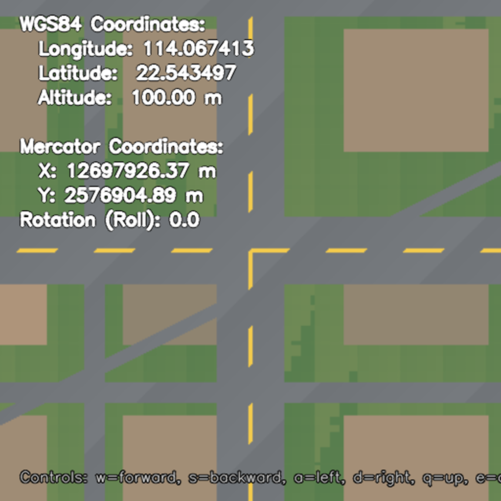
Free viewer renders the synthetic GeoTIFF and displays WGS84, Web Mercator, camera altitude, and heading.
View VLN episodes:
python -m applications.satsim_viewer task
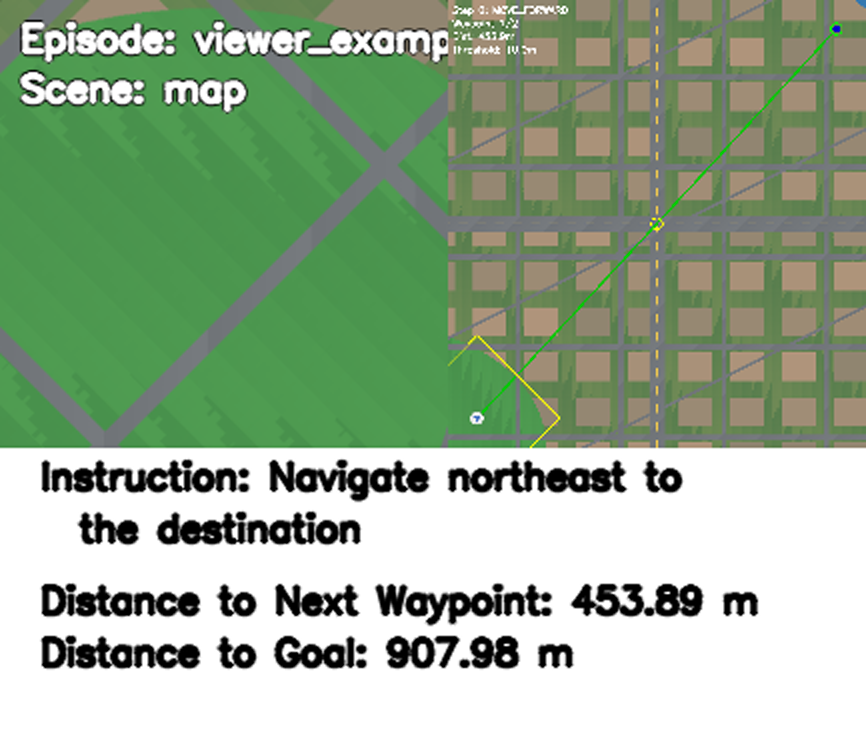
Task viewer shows RGB on the left; agent, waypoint, and reference path on the right; and instruction and distance below.
With no mode, the command defaults to free:
python -m applications.satsim_viewer
3. Inspect a custom GeoTIFF
Copy the free-viewer configuration to an ignored local file:
mkdir -p .local
cp applications/satsim_viewer/config.yaml .local/satsim_viewer_free.yaml
Set TIF_PATH and adjust movement, camera, or initial altitude as needed:
TIF_PATH: /absolute/path/to/Geneva-1.tif

SIMULATOR:
  FORWARD_STEP_SIZE: 30
  TURN_ANGLE: 15
  RGB_SENSOR:
    WIDTH: 512
    HEIGHT: 512
    HFOV: 90

AGENT:
  ALTITUDE: 100.0
  ROTATION: 0.0
  ALTITUDE_STEP_SIZE: 10.0
python -m applications.satsim_viewer free \
  --config .local/satsim_viewer_free.yaml
Free viewer starts at the scene center and displays both WGS84 and Web Mercator coordinates.
4. Inspect real episodes
Configure paths:
export SATNAV_DATA_ROOT="$PWD/data/satnav_datasets/SatNav-v0.1"
export SATNAV_SCENES_DIR="$PWD/data/satnav_datasets/scenes"
export SATNAV_EPISODES_PATH="$SATNAV_DATA_ROOT/episodes/train/all_episodes.json"
Copy the example task configuration:
mkdir -p .local
cp applications/resources/satnav_example_task.yaml \
  .local/satsim_viewer_task.yaml
Replace its DATASET block with:
DATASET:
  TYPE: SatNav
  SPLIT: train
  DATA_PATH: ${oc.env:SATNAV_EPISODES_PATH}
  SCENES_DIR: ${oc.env:SATNAV_SCENES_DIR}
Then run:
python -m applications.satsim_viewer task \
  --config .local/satsim_viewer_task.yaml
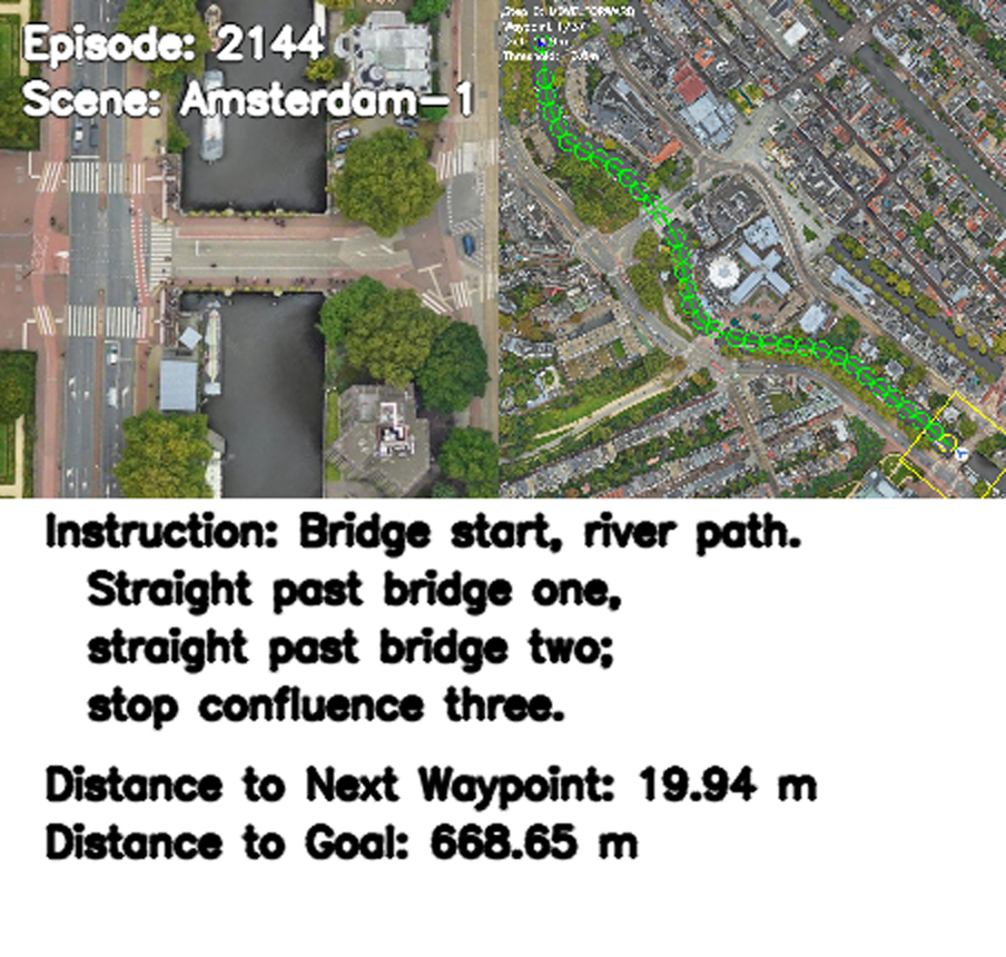
Amsterdam-1 episode 2144: current RGB on the left, full reference path and waypoint on the right, and the instruction below.
Scene files must be named <scene_id>.tif. Task viewer displays the current
instruction, distance, RGB, and top-down map. After STOP, it shows Success,
SPL, Distance to Goal, and Path Length before loading the next episode.
5. Keyboard controls
Free viewer
Key |
Action |
|---|---|
|
Move forward / backward |
|
Turn left / right |
|
Raise / lower camera altitude |
|
Save the current view |
|
Exit |
Task viewer
Key |
Action |
|---|---|
|
Move forward |
|
Turn left / right |
|
Toggle the top-down map |
|
Execute |
|
Exit |
Keyboard input targets the OpenCV window. Click the window first if keys do not respond.
6. Screenshots
Press P in free viewer to write a PNG with coordinates and state to the
repository output/ directory. The filename includes timestamp, coordinates,
altitude, and heading. output/ is ignored by Git.
7. Troubleshooting
Why can OpenCV not open a window?
The viewer needs a graphical desktop. Over SSH, configure X11 forwarding and
DISPLAY. Headless compute nodes cannot show the interactive window directly.
Why do I get TIF file not found?
Verify the GeoTIFF path in the viewer config. Machine-local paths belong in a local config or CLI argument, not a public configuration.
Why can the agent not move farther?
The camera footprint may be near the scene boundary. Change direction or lower the altitude so the rotated view remains within the GeoTIFF bounds.
Why is the initial view outside the scene?
Lower AGENT.ALTITUDE or use a larger GeoTIFF. Higher altitude requires a
larger ground footprint.
Why can Task viewer not find an episode scene?
SCENES_DIR must contain a GeoTIFF named for the logical scene_id, for
example Amsterdam-1.tif for scene_id: Amsterdam-1.
SatSim stores agent state in WGS84 and renders observations from EPSG:3857 GeoTIFFs.