SatNav Documentation
Continuous-State Vision-and-Language Navigation via Satellite Maps
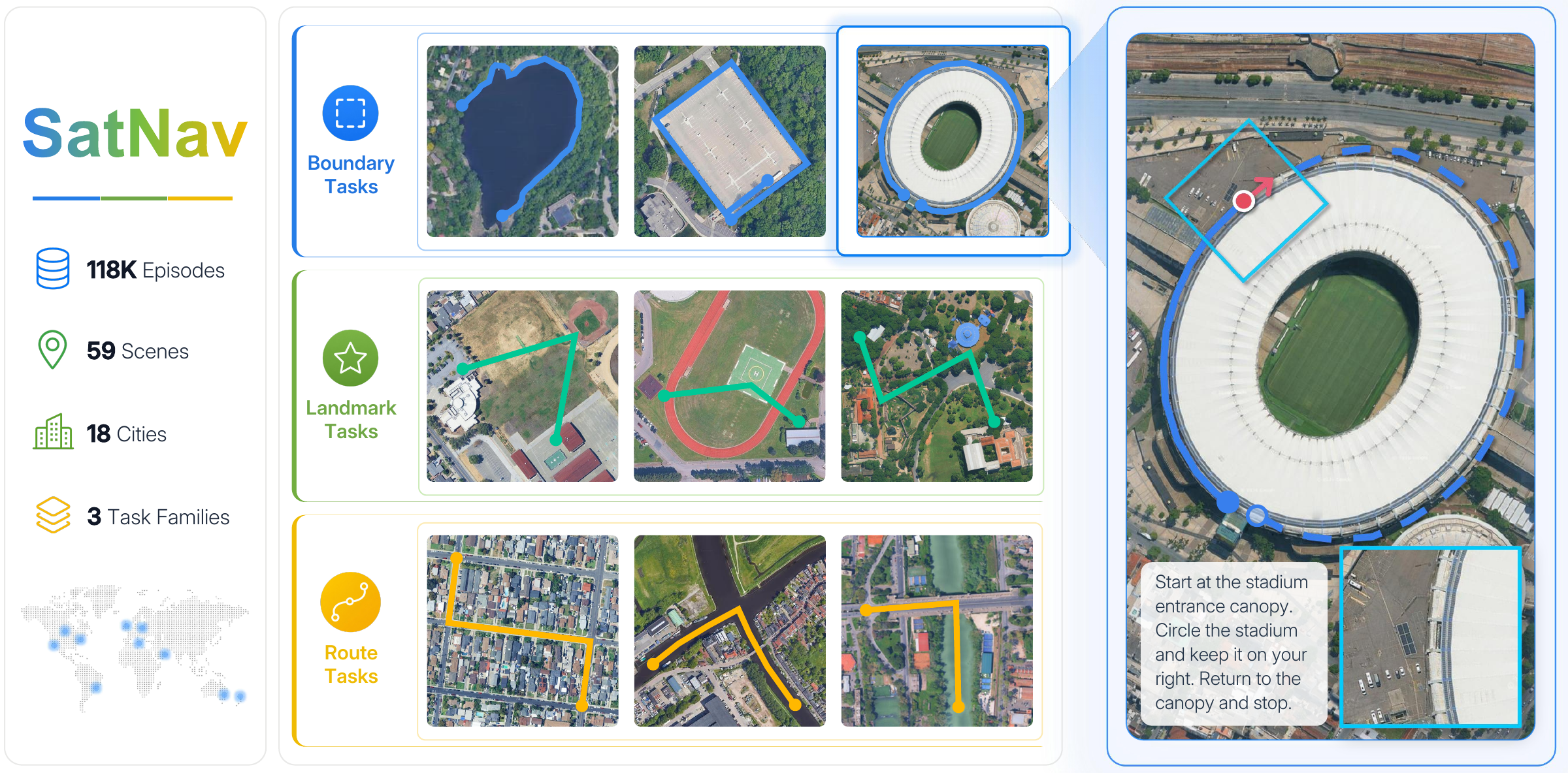
SatNav provides scene preparation, trajectory generation, model training, and online evaluation for language-guided navigation over satellite maps. Its SatSim environment renders RGB observations as agents move through continuous geographic space.
Start here
Your goal |
Guide |
|---|---|
Understand the system |
Architecture and navigation loop · SatSim observations · Tasks and metrics · Expert trajectories |
Run your first navigation episode |
|
Prepare scenes and episodes |
|
Train a navigation policy |
|
Evaluate a model |
Navigation workflow
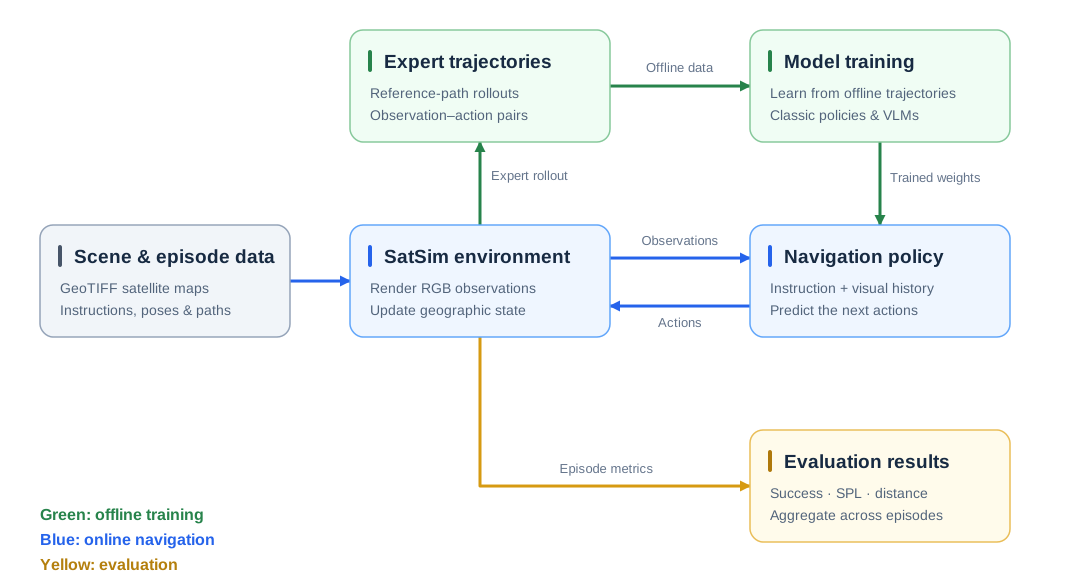
Generate expert trajectories for training, then evaluate policies through the same SatSim observation and action interface.
Resources
SatNav Episodes: 118,494 episodes across 59 scenes, with boundary, landmark, and route navigation tasks.
Model Zoo: released SatNav baseline checkpoints.
SwiftVLN: SwiftVLN setup on SatNav.